

- Joined
- Nov 2, 2025
- Messages
- 282
- Reaction score
- 0
- Points
- 16
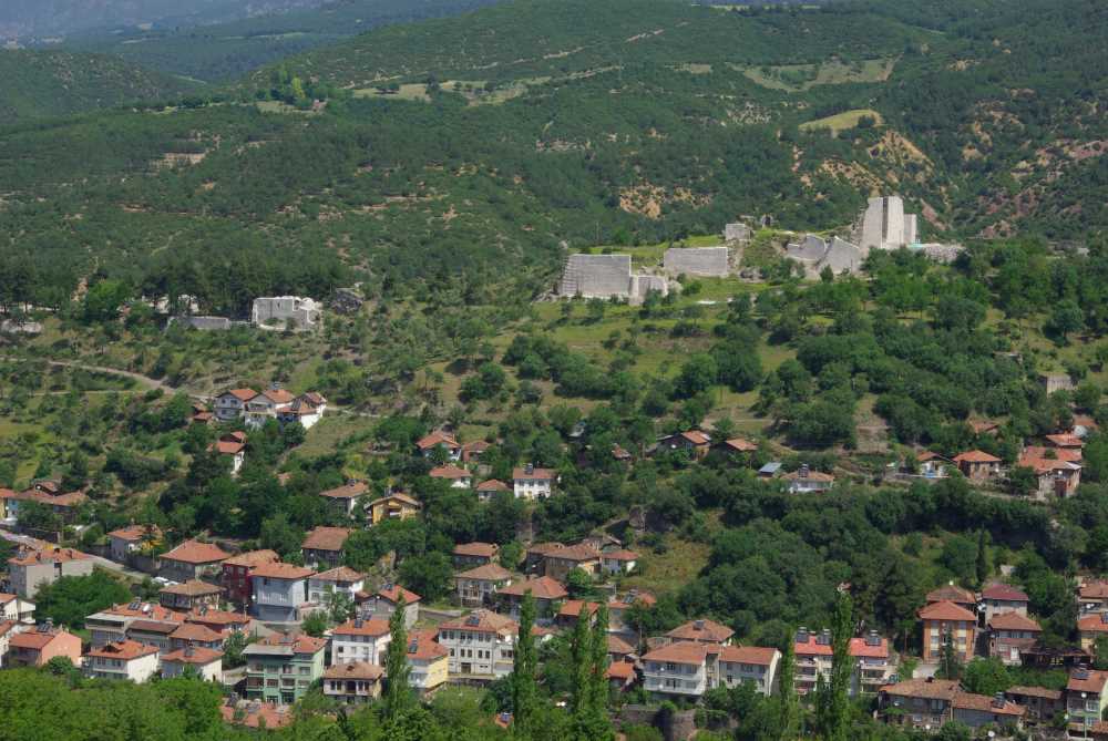
Niksar Castle's walls overlooking the town.
Niksar, Erbaa and Reşadiye reveal the variety of Tokat beyond the provincial centre, bringing agricultural plains and valleys together with castles, religious schools, lakes and mountain villages. Much of the landscape belongs to the Yeşilırmak, Kelkit and Tozanlı river systems. Towns differ according to their position between plain and slope, while nearby Almus adds a broad expanse of water. Together, they extend an introduction to the province from historic architecture to its natural and rural setting.
 Niksar and the layers of its castle
Niksar's castle has a long history of additions and repairs. Its surviving walls and structures include baths, mosques, a medrese and a church, showing that the fortified area accommodated functions beyond defence. Its high position gives it a prominent place above the town and reveals the relationship between the walls, settlement and surrounding plain.
Niksar is associated with the Danishmendid state. Yağıbasan Medrese stands out among its monuments, with part of the building connected to the castle walls. Teaching spaces, a central area and rooms add evidence of learning to the history of government and fortification. This is a different building from Yağıbasan Medrese in Tokat city, although both share the historical name.
 Erbaa: plains and rivers
Erbaa occupies an agricultural area connected with the Kelkit valley and the confluence of watercourses within the Yeşilırmak system. Plains and fertile land give it a clear rural and economic character, with fields and villages central to its surroundings. The rivers help explain the area's importance for farming and communication between inland towns, while old bridge remains recall those connections.
Historic Boğazkesen Bridge is associated with routes linking the Amasya and Niksar areas. The remains at Horoztepe reveal the depth of settlement around Erbaa. These sites represent different aspects of local history: river crossings, early settlement and working the land. Comparing them helps explain the connection between heritage, terrain and the resources on which residents have long depended.
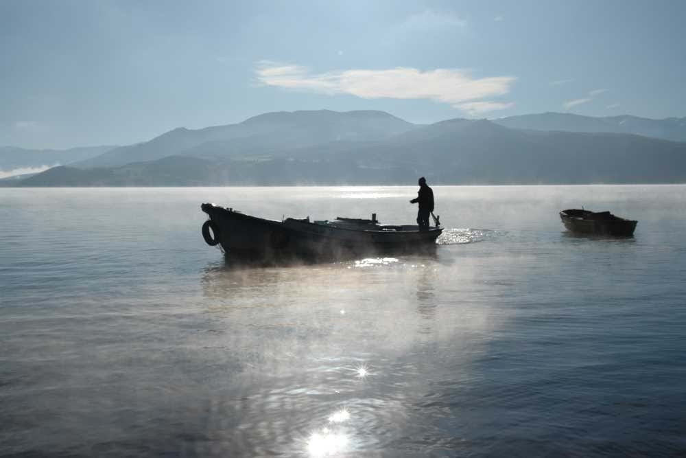
Almus Reservoir and the surrounding hills in Tokat province.
 Reşadiye and Lake Zinav
Lake Zinav and its valley lie near Yolüstü village in Reşadiye district. The area includes a nature park, water, woodland and rock formations. The lake differs from the neighbouring deep gorge: one is a body of water enclosed by slopes, the other a narrow landform revealing the work of flowing water and erosion. This contrast adds variety within a single geographical area.
Reşadiye is also associated with upland pastures, villages and locally known thermal resources. Together they show the transition from town to high ground, where grazing land, forests and rural homes appear. Water, land and local life shape the area's identity, with changes in weather and vegetation between valleys and higher places influencing village form and residents' activities.
 Almus and the province's landscapes
Almus Reservoir provides another example of water's prominence in Tokat. It lies in Almus district on the upper Yeşilırmak river system, surrounded by woodland and high ground. Its winding shores form numerous inlets, creating a different scene from small lakes or irrigation channels on the plains. Fish farming gives it a productive role alongside its broad landscape appeal.
Niksar, Erbaa, Reşadiye and Almus offer four complementary settings: a fortified historic centre, an agricultural plain, a lake-and-gorge landscape, and a reservoir among hills. The province's towns have distinct characters. Location, altitude, water and settlement history give each its own features within the inland Black Sea region.
 Practical notes
Check access to castle sections and nature routes before entering. Zinav Gorge has different terrain from the lakeside path and may require specialist arrangements and equipment. Use permitted shores, respect farms and villages, and do not enter dam areas or closed routes in search of a viewpoint.
 Related topics
- Amasya 2026: The Yeşilırmak River, Yalıboyu Houses and Harşena Castle
- Amasya 2026: Museums, the Bimarhane and Bayezid II Complex
- Merzifon and Gümüşhacıköy 2026: Heritage and Countryside
- Lake Boraboy, Taşova and Suluova 2026: Water and the Plains
- Tokat 2026: The Castle, Gök Medrese, Taşhan and Historic Houses
- Zile, Turhal and Pazar 2026: Castles and Ballıca Cave
- Çorum 2026: Hattuşa, Alacahöyük and Hittite Museums
- Bartın and Amasra 2026: The Coast, Castle and Rural Heritage
- Zonguldak 2026: Coal Heritage, the Mining Museum and Gökgöl Cave
Last edited by a moderator: