

- Joined
- Nov 2, 2025
- Messages
- 282
- Reaction score
- 0
- Points
- 16
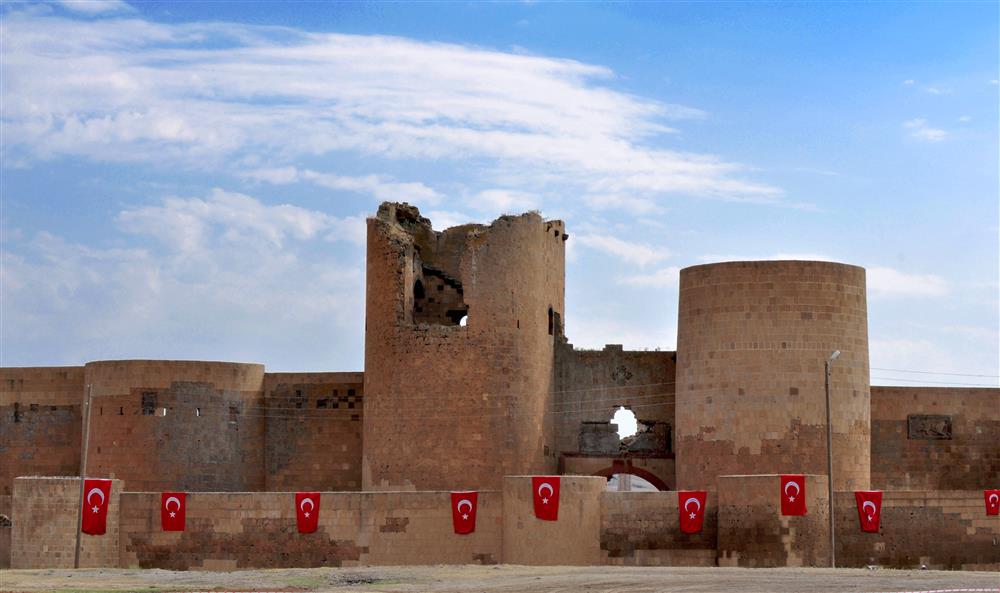
Ani's walls and gateways frame a wide archaeological landscape.
Ani lies about 42 kilometres from Kars beside the village of Ani, also known as Ocaklı, on a plateau overlooking the Arpaçay gorge at the Armenian border. Its scale becomes clear on foot: walls, religious monuments and former urban spaces are spread across a broad, exposed site.
Inscribed on the UNESCO World Heritage List in 2016, Ani deserves more than a quick stop at a single building. Leave enough time to understand how the medieval city relates to its surrounding landscape.
 Understanding the Medieval City
Ani flourished in the tenth and eleventh centuries as a capital of the Bagratid Armenian kingdom and a centre of Silk Road trade. Successive rulers and communities contributed to its varied architectural traditions.
As you walk, imagine streets, markets, homes and places of worship between the standing monuments. The gates, principal buildings and gorge together explain the city more fully than any one landmark.
 Walls, Gates and a Walking Route
The surviving walls and gateways are a useful starting point for understanding Ani's defences and urban boundaries. Follow the permitted routes and choose a manageable sequence through the religious monuments and towards the gorge viewpoints.
Restoration work, ground conditions or site management may affect the route available on the day. Allow time for walking between buildings rather than treating them as adjacent stops.
 Churches, the Cathedral and the Mosque
The early eleventh-century Cathedral, the frescoed Church of Tigran Honents and Ebu'l Menuçehr Mosque illustrate different parts of Ani's religious and architectural history.
Look closely at walls, arches, decoration and inscriptions from authorised viewing positions. Avoid touching painted or carved surfaces and climbing the structures. A specialist guide can help explain the buildings' functions, phases, construction and inscriptions.
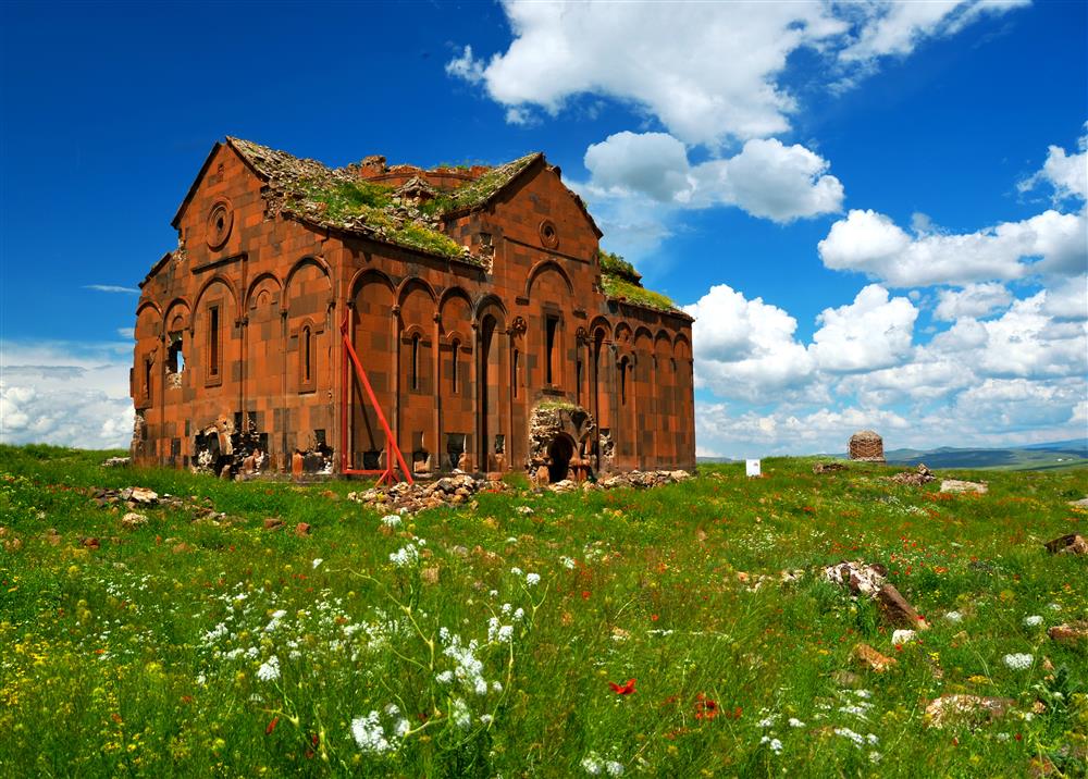
Ani Cathedral.
 The Arpaçay Gorge
The deep gorge and remains of the historic Silk Road bridge reveal why Ani's setting mattered for defence and trade. The story of the city extends beyond its walls.
Use designated viewpoints to appreciate the relationship between the river, plateau and buildings. Keep away from exposed edges and follow staff instructions around restricted areas.
 Getting There and Allowing Enough Time
A car, taxi or organised excursion can provide access from Kars. If considering a local bus, confirm its actual departure point, outward service and return arrangements rather than relying on an old timetable.
Allow several unhurried hours, taking account of admission arrangements, the weather and walking distances. Bring water, stable footwear and layers suitable for wind, and know how you will return to Kars.
 Photography and a Considerate Visit
Allow time to read, take photographs and rest between monuments, and follow any photography restrictions. In harsh weather or poor visibility, prioritise the principal monuments rather than extending the walk simply to complete a list.
Leave stones in place, take litter away and respect closed areas. If your schedule allows, give Ani a separate day from central Kars so that both can be explored at a comfortable pace.
 Related topics
- Kars 2026: Castle, Architecture and University Life
- Kağızman, Digor and Arpaçay 2026: The Aras Valley and Rural Kars
- Sarıkamış 2026: Pine Forests, Skiing and Railway Heritage
- Lake Çıldır 2026: Seasonal Scenery and Fishing Between Kars and Ardahan
- Ardahan 2026: Castle, Kura River and Highland City Life
- Posof and Damal 2026: A Border Valley, Red Apples and Highland Heritage
- Göle and Hanak 2026: Forests, Dairy Farming and Rural Life
- Erzurum: The Historic Capital of Eastern Türkiye
- Erzincan: A Natural Oasis in Eastern Anatolia
Last edited by a moderator: