

- Joined
- Nov 2, 2025
- Messages
- 282
- Reaction score
- 0
- Points
- 16
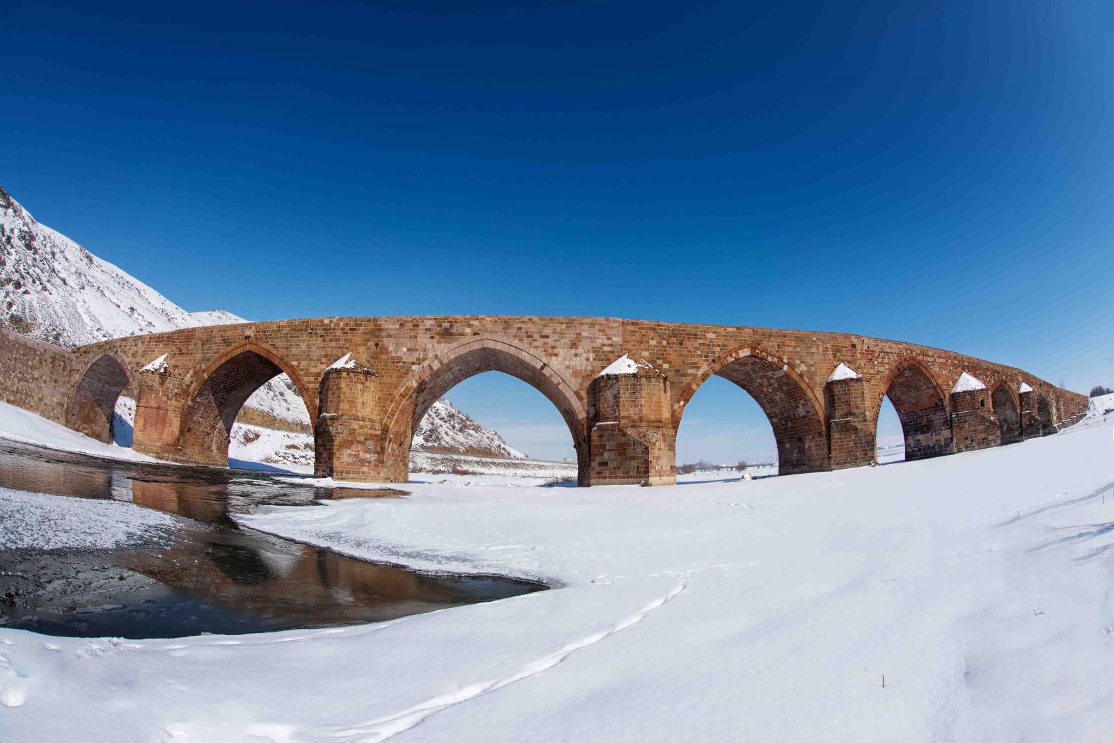
The historic Çobandede Bridge.
East of Erzurum lies a belt of plains and towns shaped by the Aras River, farming and ancient routes. Pasinler, Köprüköy and Horasan reveal another side of the province: fields between mountains, local centres serving the countryside, and monuments explaining the importance of this corridor over the centuries.
This 2026 guide explores the area and its economy while retaining the dates given in official programme and project announcements.
 Pasinler: Plain and Castle
The Kargapazarı Mountains border the plain to the north and extensions of the Palandöken range to the south. The Hasankale Stream passes through the town before joining the Aras near Çobandede Bridge. Understanding the plain and its waterways helps explain the distribution of fields and villages and places the town within its wider setting.
Hasankale Castle overlooks this landscape, while hot springs form another part of Pasinler’s identity. Surface water and thermal springs connect the natural environment with settlement and livelihoods. The position between mountains also helps explain the town’s historical importance in Eastern Anatolia.
 Köprüköy: Crossing the Aras
Erzurum’s provincial administration describes Köprüköy’s economy as based on agriculture and livestock. Its best-known landmark is Çobandede Bridge, dated by the Turkish Culture Portal to 1298 and built along the historic Silk Road.
The bridge is distinguished by arches of black, red and grey stone. The portal records its restoration in 2011.
Its value extends beyond its appearance: it shows how crossing the river shaped trade and the surrounding area. Protecting both bridge and riverbanks helps preserve the relationship between heritage, the river and the towns that grew around the route.

Horasan and its surroundings.
 Horasan: Farming and Roadside Services
Horasan stands beside the Aras on the Erzurum–Kars corridor, with a railway running through it. Its land includes level areas along the river and sparsely vegetated uplands on either side.
The culture directorate notes that farming draws on Aras water and includes wheat, while livestock is especially important in villages and mountain areas.
This location helps explain the town’s role in retail, repairs and the trading of produce. Roads and railways alone, however, do not demonstrate new prosperity. Assessing growth requires current evidence about jobs, production and services as well as traffic passing through the area.
 Improving Production and Protecting the Plain
One documented example is the North-East Anatolia Development Agency’s April 2024 announcement of a technical-support agreement for a Horasan programme. It aimed to train livestock farmers in 12 villages in techniques to reduce calf deaths. The announcement sets out the programme’s objective; it does not provide a final outcome that can be presented as a 2026 achievement.
The area’s agricultural character suggests practical development priorities:
- Improving fodder quality and veterinary care alongside decisions about herd size.
- Strengthening produce storage and marketing and connecting growers with markets.
- Protecting cultivated land and waterways as towns expand.
- Maintaining historic landmarks while respecting their cultural uses.
 Related topics
- Erzurum 2026: Heritage, University Life and Urban Change
- Palandöken and Konaklı 2026: Erzurum’s Winter Economy
- Aziziye, Aşkale and Çat 2026: Plains, Hot Springs and Rural Life
- Tortum and Uzundere 2026: Lake, Waterfall and Valley Villages
- Narman, Oltu, Olur and Şenkaya 2026: Red Rocks and Oltu Stone
- İspir and Pazaryolu 2026: The Çoruh Valley, Beans and Ovit
- Southern Erzurum 2026: Hınıs, Tekman, Karayazı and Karaçoban
- Erzurum: The Historic Capital of Eastern Türkiye
- Erzincan: A Natural Oasis in Eastern Anatolia
Last edited by a moderator: