

- Joined
- Nov 2, 2025
- Messages
- 282
- Reaction score
- 0
- Points
- 16
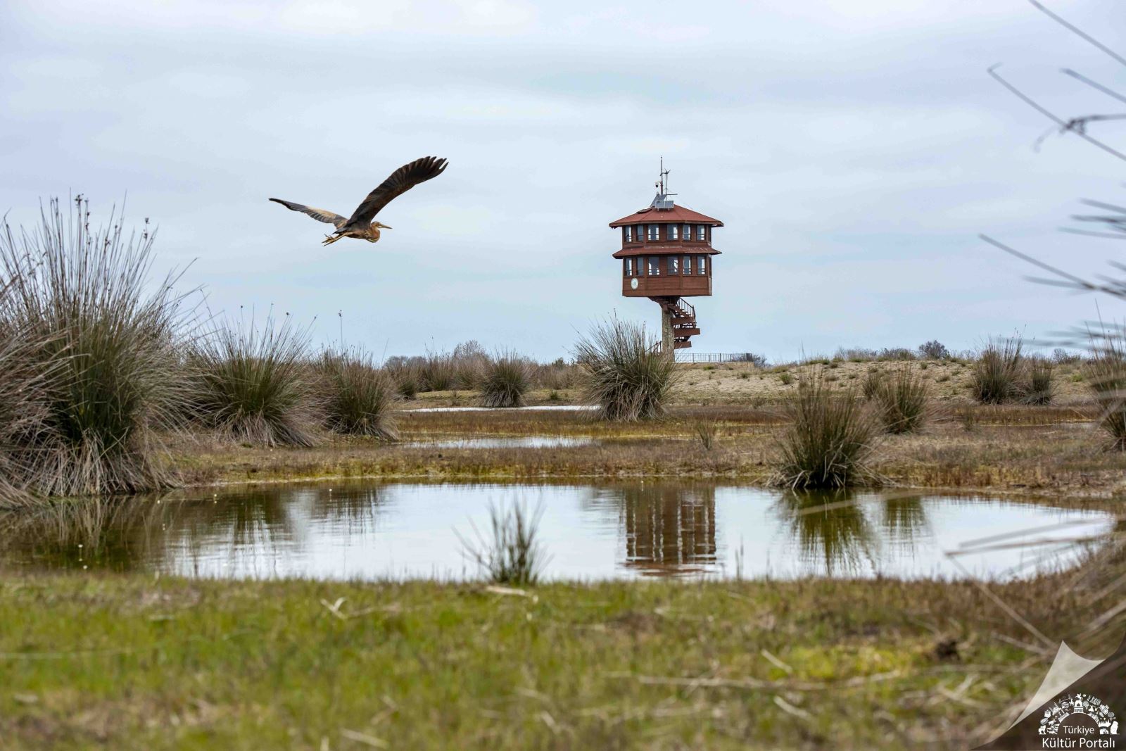
Wetlands and a birdwatching tower in the Kızılırmak Delta.
Bafra is one of western Samsun's districts, its identity shaped by the agricultural plain, Kızılırmak River, villages and archaeological sites. Near the sea, the delta spreads into lakes, reeds, meadows, dunes and wet woodland. This natural system extends across Bafra, 19 Mayıs and Alaçam, while the surrounding countryside connects the town's productive land with a long settlement history preserved at İkiztepe and in museum collections.
1.  The Delta and Its Coastal Lakes
Built from sediment carried to the coast by the Kızılırmak, the delta extends well beyond a narrow river mouth. Lakes including Balık, Cernek, Uzun and Karaboğaz differ in their waters and connections with sea and surrounding reeds. Low-lying land supports open water, marsh and pasture whose edges and appearance change with season and water level.
This variety forms an interconnected system. Open water serves organisms different from those of reedbeds, woodland and dunes. The wetlands also contribute to local water balance and connect with fishing, grazing and village resources. Their value lies in the continuity of these habitats and the relationship between river, sea and land.
2.  Birds and Galeriç Forest
The Kızılırmak Delta supports resident birds and seasonal migrants, providing feeding, breeding and resting areas, particularly for birds crossing the Black Sea. Pelicans, herons, ducks and storks are familiar examples, with sightings varying by time, water conditions and season. Different habitats and food sources underpin this richness.
Galeriç Forest adds another distinctive environment: its floor floods for part of the year, particularly in spring. The recognised woodland lies north of Yörükler, with deciduous trees and habitat for woodland birds. Water between the trunks distinguishes it from open pasture, while drier sections and surrounding reeds complete the wider network of life.
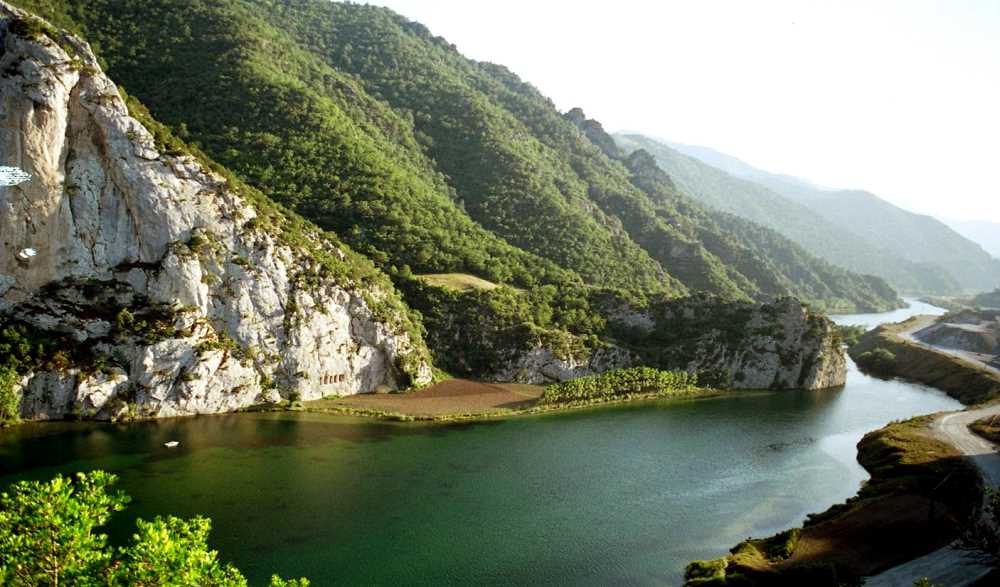
The Kızılırmak between hills around Kolay and Bafra.
3.  İkiztepe and Bafra Museum
İkiztepe lies in the village of the same name, about 7 kilometres from Bafra and comprises several mounds with different cultural layers. Excavations have uncovered metal tools, pottery, bone and stone objects, and evidence of crafts, textiles and burial practices. These finds reveal settled communities with developed skills and technologies on the Bafra plain long before later historical periods.
Bafra Museum holds archaeological material from İkiztepe and regional ethnographic displays in a restored historic building. Exhibits connect objects with local life and culture. The museum complements the archaeological site: mounds retain the context of settlement, while displays make materials, tools and manufacturing details easier to distinguish. Bafra's heritage thus extends from inhabited ground to the objects left by its people.
4.  The Plain, Villages and Local Economy
The Bafra plain is a major agricultural part of Samsun, visible in its fields, villages and produce markets. Water buffalo farming adds to the rural landscape around the delta, alongside activities linked with water and pasture. Buffalo belong to local life and wetland land use, while the town remains a centre for services and exchange.
Inland, the landscape changes to reservoirs, higher terrain and sites such as Asarkale and rock-cut tombs. Bafra combines plain, water and nearby heights. Villages, ancient settlement remains and natural habitats together reveal a district where agriculture, history and wildlife overlap, requiring a balance between local use and environmental protection.
5.  Practical Notes
Use authorised paths and observation points; avoid nests and do not feed birds or buffalo. Check current protected-area entry rules and available visitor transport. Ground can be muddy after rain. Watching from a suitable distance helps keep habitats undisturbed.

Bafra Museum; Samsun Provincial Culture and Tourism Directorate photograph, Turkish Culture Portal.
6.  Choosing Your Bafra Stops
| Place | What to see | How to visit |
|---|---|---|
| Delta lakes and reedbeds | Wetlands and birdlife that change with the season | Use authorised observation points and paths |
| Galeriç Forest | Wet woodland with seasonal water conditions | Follow accessible paths and expect mud after rain |
| Bafra Museum | İkiztepe finds and local everyday life | Check museum hours before arranging your route |
| İkiztepe | Archaeological mounds and the settlement setting | Confirm site access; use the museum for object displays |
7.  A Flexible One-Day Plan
| Time | Suggestion | Adjustment if needed |
|---|---|---|
| Morning | Quiet delta observation from permitted locations | Choose accessible points according to weather and protection rules |
| Midday | A break in Bafra, then the museum if open | Start with the museum if its hours make that more practical |
| Afternoon | İkiztepe if access is confirmed, or a town walk | Treat Kolay and Asarkale as a separate extension when time and transport allow |
 Related topics
- Samsun 2026: The Coastal City, Bandırma and History Museums
- Amisos, Atakum and Tekkeköy 2026: Samsun’s Heritage and Coast
- Çarşamba and Terme 2026: Yeşilırmak, Lakes and Wooden Mosques
- Inland Samsun 2026: Şahinkaya, Vezirköprü, Havza and Lâdik
- Sinop 2026: Castle, Historic Prison, Balatlar and Museums
- Northern Sinop 2026: Hamsilos, İnceburun, Akliman and Sarıkum
- Sinop’s Districts 2026: Ayancık, Erfelek, Boyabat and Gerze
- Lake Boraboy, Taşova and Suluova 2026: Water and the Plains
Last edited by a moderator: