

- Joined
- Nov 2, 2025
- Messages
- 282
- Reaction score
- 0
- Points
- 16
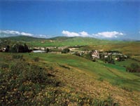
A view of Refahiye.
Refahiye and İliç present two different rural landscapes in Erzincan province: pine-covered uplands in the north-west and mountain towns and villages connected with the Karasu further south. Both depend on farming and livestock, while roads and mining give them different roles in the provincial economy.
 Refahiye: Uplands at a Road Junction
Refahiye stands where the broader regions of Eastern Anatolia, the Black Sea and Central Anatolia meet. Its centre is approximately 1,580 metres above sea level. The E80 passes through the district, with mountain passes such as Kızıldağ and Sakaltutan nearby.
The town serves movement between regions as well as its surrounding villages. Relatively mild summers contrast with long, snowy winters, a seasonal difference that helps explain settlement patterns and agricultural work.
 Dumanlı's Forests
The Dumanlı uplands west of Refahiye, between Soğukgöze and Karaçam, combine pine forests, meadows and cold springs at around 2,000 metres. Dumanlı is designated a nature park within the official protected-area network.
Woodland shapes the area's wider identity, while Kalkancı and Akarsu dams connect the mountain environment with irrigation needs. Kadıköy Church and the central mosque add architectural and historic layers to the rural landscape.
 Crops, Fodder and Honey
Cold winters limit some fruit and vegetable growing. Wheat, barley, lucerne and korunga, or sainfoin, are notable crops. Fodder cultivation complements livestock keeping, and beekeeping provides an important rural income.
Honey also features in social life. In August 2026, Refahiye Municipality published a report marking the conclusion of the nineteenth Honey Festival. Crafts and commerce in the district centre complement village production of crops and animal products.
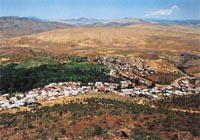
A view of İliç.
 İliç: Villages and Dairy Production
İliç differs from Refahiye's uplands. The Karasu runs north of the town and crosses district land from north-east to south-west. Deeply dissected terrain places settlements at varying elevations.
Sheep, goats and milk production are visible parts of rural activity, while tulum cheese contributes to Erzincan's food identity. Railway arrival in 1938 was a turning point, when the administrative centre moved from Kuruçay to İliç. The railway therefore helps explain the town's growth and role.
 Mining and the Environment
The district administration identifies iron, chromium and barite deposits among İliç's resources, alongside gold mining's place in its economy. On 13 February 2024, a landslide at a gold mine killed nine workers. The Ministry of Energy subsequently documented funeral ceremonies for them.
The disaster is important to understanding the relationship between mining, workers' safety, land and surrounding water. Mineral deposits alone do not establish that a facility is operating or that a new investment has been approved; those claims require separate, dated official evidence.
 Related topics
- Tercan, Çayırlı and Otlukbeli 2026: Plains and Rural Heritage
- Ovacık and Pülümür 2026: Valleys and Rural Life
- Hozat and Nazımiye 2026: Mountain Towns and Rural Heritage
- Erzincan and Üzümlü 2026: Plains, Cimin Grapes and Urban Life
- Kemaliye and Kemah 2026: Karasu Valley and Local Heritage
- Southern Tunceli 2026: Pertek, Mazgirt and Çemişgezek
- Tunceli City 2026: Rivers, Museum and University Life
- Erzurum: The Historic Capital of Eastern Türkiye
- Elazığ: Lakes and Deep Anatolian Heritage
Last edited by a moderator: