

- Joined
- Nov 2, 2025
- Messages
- 282
- Reaction score
- 0
- Points
- 16

A panoramic view of the lakes within Nemrut Caldera and the surrounding crater walls.
A Tatvan outing combines the Lake Van shore with the volcanic scenery around Nemrut in Bitlis province. Here, Nemrut refers to the volcano and its crater lakes. Use that description when searching for directions or booking a trip.
The town makes a starting point for exploring water and high ground, while the caldera deserves separate time for sightseeing, walking and photography.
Nemrut Caldera was designated a national park by a decision published on 19 August 2026. This protected status does not establish access to every road or activity; follow the entrances and routes permitted on the day.
 Tatvan on the south-western shore
Tatvan lies on the south-western side of Lake Van, surrounded by mountains with Nemrut to its north-west. This explains the contrast between a lakeside stop and the ascent into the volcanic landscape.
Begin near the lake to appreciate its scale and relationship with the town, then plan a separate mountain visit. If your trip also includes Bitlis and Ahlat, place them on a clear map before choosing where to stay.
Ahlat and Adilcevaz are other towns on the lake that can be included according to your time and interests.
 A caldera revealing the landscape's origins
Nemrut stands between Tatvan, Ahlat and Güroymak. Its caldera, the broad volcanic basin, contains lakes and several volcanic features, including lava vents and cones.
Regional geographical descriptions liken the mountain to a cone with its top cut off. Looking first at the rim and then at the water within helps distinguish the caldera from a lake on an open plain.
For photographs, include a broad view of the formation, a composition showing the relationship between rim and water, and a closer view of the rocks and volcanic details.
 Lakes in a volcanic environment
Lake Nemrut is fed by snowmelt and springs, and its main lake is described as cold freshwater. This contrasts with the saline, alkaline waters of neighbouring Lake Van.
The caldera also contains warm springs and other water features, alongside varied plants and habitats within one area. Notice this diversity as you walk, without making every pause into a separate activity.
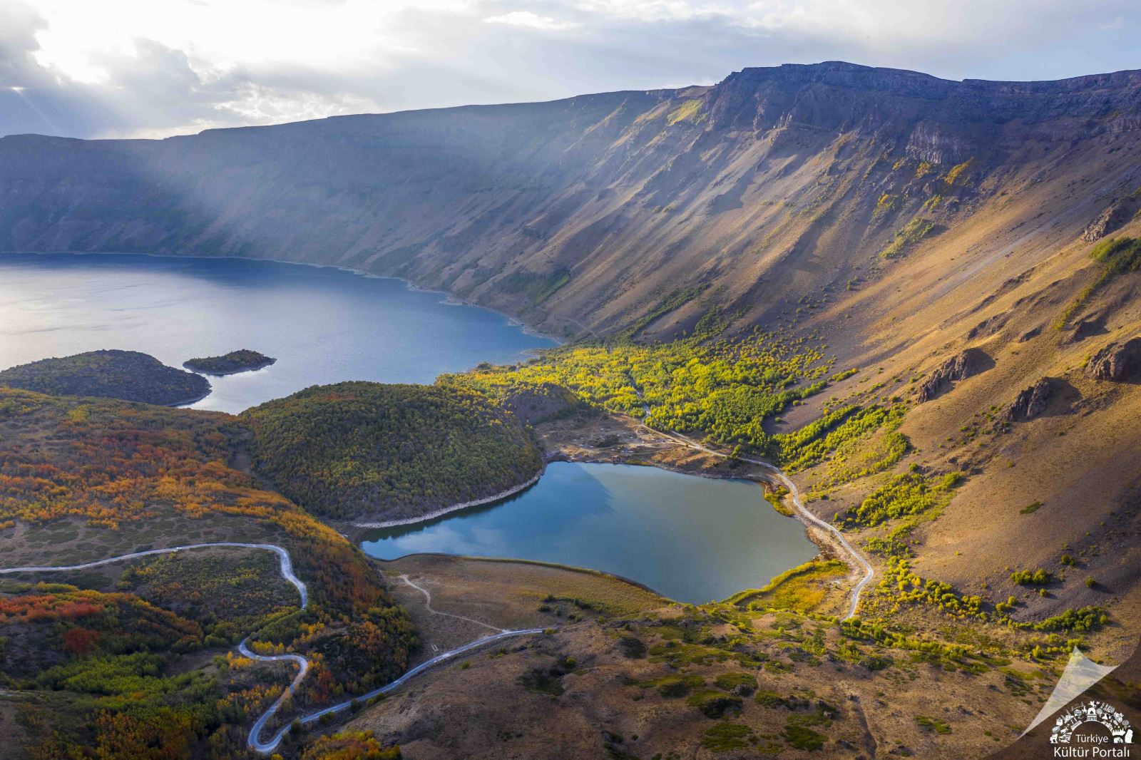
Nemrut’s lakes, crater slopes and roads in a landscape touched by autumn colours.
Look at the vegetation, water and rock together. Understanding their connections makes the outing richer than concentrating solely on a photograph of the lake.
 Choose your approach
Published approaches to Nemrut include the Tatvan–Çekmece village road and the Ahlat–Serinbayır village road. Choose according to your starting point, remembering that a listed approach is not necessarily suitable in every season or for every vehicle.
Check locally which route is appropriate on the day and agree a return time if you have booked a car. Separate the lakeshore visit from the caldera ascent if the weather or available time makes combining them impractical.
Let current road and weather conditions determine the mountain programme.
 Nature watching and a short itinerary
- Stop on Tatvan's lakeshore to understand the town's setting.
- View the shape of the caldera, then pause beside its lake.
- Choose a walk suited to your group and allow time for photographs before returning.
Walking, wildlife observation and photography are among the area's activities. Select according to your interests: a short, unhurried route can provide better opportunities to observe than an attempt to do everything.
The caldera is a sensitive natural environment. Follow site signs, do not enter the lake or light fires, and leave wildlife undisturbed without feeding or approaching animals.
 Related topics
 - Bitlis 2026: The Historic City, Stone Houses and Castle
- Ahlat and Adilcevaz 2026: Seljuk Gravestones and Lake Van Heritage
- Edremit 2026: Lake Van Shore, Walks and Viewing Terraces
- Akdamar and Gevaş 2026: Island Heritage and Stone Architecture
- Muradiye and Erciş 2026: The Waterfall and Lake Van’s Fish Migration
- Van Castle, Old Van and Ayanis 2026: Urartian Heritage
- Van 2026: University Life, Breakfast and the Everyday City
- Bitlis: An Ottoman Mountain City in Eastern Türkiye
- Van: The Pearl of the East and Its Legendary Lake
Last edited by a moderator: